
Bookmarks
Showing Bookmarks 1 to 5 of 5
-
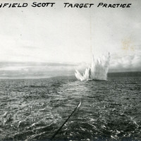
Caption: "Fort Winfield Scott Target Practice." This postcard shows a plume of seawater thrown up by a mortar shell during target practice at Fort Point. Fort Point was part of an effort by the U.S. government to protect the Golden Gate, entrance to the San Francisco Bay. Built between 1853-1861, the fort included emplacements for 141 guns but never fired a weapon in defense of the Bay. Its name was officially changed in 1882 to Fort Winfield Scott. This only lasted four years, however, for in 1886 the fort was officially downgraded to a sub-post of the San Francisco Presidio and the name discontinued. It was resurrected in 1912, with the establishment of a coastal artillery fortification at the Presidio, called, once again, Fort Winfield Scott. See also 96-07-08-alb08-029.
Date: 1909-10-25
-
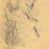
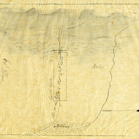
Hand-drawn sketch map of Cañada de los Osos y Pecho y Islae boundaries. Volume 2, page 11.
Date: 1842
-
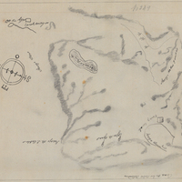
Hand-drawn sketch map of Lauguna de los Palos Colorados boundaries. Volume 1, page 666.
Date: 1834
-
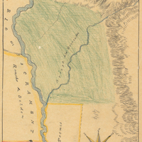
Hand-drawn sketch map of Rio de los Berrendo boundaries. Volume 2, page 98.
Date: 1844
-
Hand-drawn sketch map of Rio de los Putos boundaries. Volume 1, page 732.
Date: 1842