
Bookmarks
Showing Bookmarks 1 to 3 of 3
-
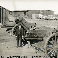
Caption: "6 inch Howitzers -- Camp Kearney," c. 1917. View of several 6" Howitzers, as well as several outbuildings and a line of artillery weapons under canvas covers. William McCarthy is standing next to the middle Howitzer. Camp Kearney was established by the U.S. Army in 1917 just north of San Diego. The post was largely abandoned by the government in 1920, used as a military and civilian airfield. It did not see increased military service again until the 1930s.
Date: 1917
-
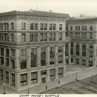
Caption: "Court House -- Seattle.," c. 1916. The King County Courthouse in downtown Seattle, Washington, was built in 1916 as a five-story structure, as shown in this photograph. Six floors were added in 1930, and another three before 1965. In 1967, a massive remodeling project imposed aluminum curtain walls on the building's east and west sides, changed the main entryway switched to Third Avenue rather than Jefferson Street, and made other changes to the interior.
Date: 1916
-
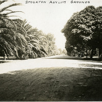
Caption: "Stockton Asylum Grounds," Stockton, California, c. 1906. The Stockton Insane Asylum was established in 1851, completed in 1853, and was the first public mental health hospital in California. It remained a functioning state hospital until 1995.
Date: 1906