
Bookmarks
Showing Bookmarks 1 to 5 of 5
-
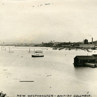
Caption: "New Westminster -- British Columbia.," c. 1908-1912. View of the riverfront of New Westminster, now part of the Greater Vancouver region.
Date: 1908
-
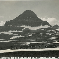
Caption: "Mount Reynolds - Logan Pass - Glacier National Park," c. 1935.
Date: 1935
-
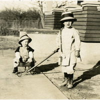
No caption, c. 1915. Unidentified child pulling another unidentified, smaller child in a wagon.
Date: 1915
-
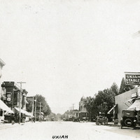
Caption: "Ukiah," c. 1920. Street scene in Ukiah, with Ukiah Stables and The Richelieu at right.
Date: 1920
-
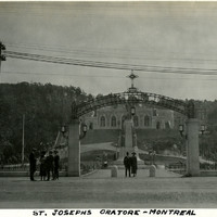
Caption: "St. Josephs Oratore [sic] - Montreal," c. 1925. William and Grace McCarthy beneath the entry arch to the complex containing St. Joseph's Oratory, a Roman Catholic basilica and shrine. Work on the building began in 1924, and continued until 1967. Only the first level of the building had been completed when this photograph was taken.
Date: 1925