
Bookmarks
Showing Bookmarks 1 to 4 of 4
-
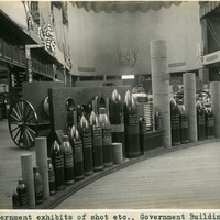
Caption: "Government exhibits of shot etc., Government Building." Exhibit of various types of heavy ordnance shells, including armor piercing shells as well as torpedoes. The exhibit was located in the Government Building of the Lewis and Clark Centennial Exposition, held in Portland, Oregon from June 1st to October 15th, 1905. It celebrated the one-hundred year anniversary of the exploratory expedition of the Louisiana Purchase and what became the northwestern part of the United States, led by Meriwether Lewis and William Clark. Some 1.6 million people visited the fair, viewing exhibits from twenty-one countries. See also 96-07-08-alb05-206.
Date: 1905
-
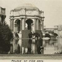
Caption: "Palace of Fine Arts," with William McCarthy smiling for the camera at the Panama-Pacific International Exposition. See also 96-07-08-alb03-104.
Date: 1915
-
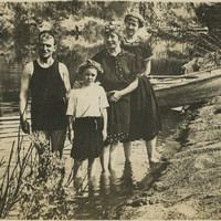
No Caption: William McCarthy (left) and Grace (far right), enjoying summertime at the Russian River with unidentified woman and child, c. 1915.
Date: 1915
-
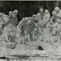
No Caption: A large marble sculpture, The Mystery of Life (Ernesto Gazzeri, sculptor), on the grounds of Forest Lawn Memorial Park in Glendale, Los Angeles, c. 1935.
Date: 1935