
Bookmarks
Showing Bookmarks 1 to 4 of 4
-
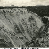
Caption: "Yellowstone Grand Canyon," c. 1923. One wall of the Grand Canyon of the Yellowstone can be seen in this photograph, viewed from the opposite rim of the Canyon. The Canyon is approximately 24 miles long, and between 800 and 1,200 feet deep.
Date: 1923
-
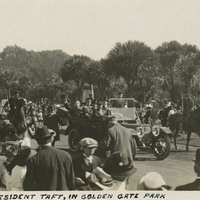
Caption: "President Taft in Golden Gate Park." See also 96-07-08-alb01-004, with caption: "President Taft in the Park." October 14, 1911. President William Howard Taft in San Francisco's Golden Gate Park during the groundbreaking ceremony for the Panama-Pacific International Exposition, which was slated to open January 1915.
Date: 1911
-
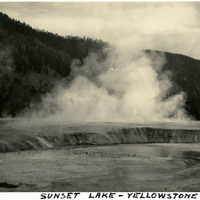
Caption: "Sunset Lake - Yellowstone," c. 1923. Yellowstone National Park's Sunset Lake is a shallow thermal pool in the Black Sand Basin. Its name is derived from the yellow and orange bands of bacteria and algae at its edges.
Date: 1923
-
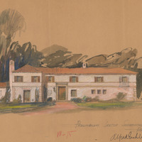
Caption: "Preliminary Sketch Superintendent's Residence - Pacific Colony." The residence was built to a later design. Project for Department of Mental Hygiene - Hospitals. The hospital was initially named Pacific Colony (1927-1953), followed by Pacific State Hospital (1953-1979); Frank D. Lanterman State Hospital and Developmental Center; and finally Lanterman Developmental Center, which closed in 2015.
Date: 1925