
Bookmarks
Showing Bookmarks 1 to 4 of 4
-
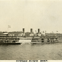
Caption: "Hudson River Boat," c. 1925. The Washington Irving, a three-stack steamer ship, is shown in this photograph. The ship was in operation from 1913 to 1926, when it collided with an oil barge and sank.
Date: 1925
-
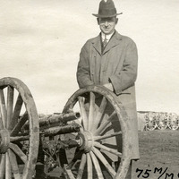
Caption: "75m/m gun," c. 1906. William McCarthy is seen posing next to a large gun at an unidentified location.
Date: 1906
-
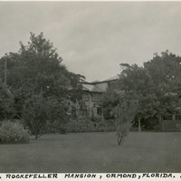
Caption: "John D. Rockefeller Mansion, Ormond [sic], Florida. July 10, 1934." A large mansion can be glimpsed through surrounding trees and other vegetation in this photograph. The mansion is known as the Casements, for the numerous casement windows incorporated into its structure. Built in 1914 in Ormond Beach, John D. Rockefeller purchased the home in 1918 for use as a winter residence. After Rockefeller died in 1937, the property was sold several times, until the City of Ormond Beach bought it in 1973. The city renovated it for use as a cultural and community center, a purpose which it still serves.
Date: 7/10/1934
-
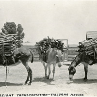
Caption: "Freight Transportation -- Tiajuana [sic], Mexico," c. 1915-1916. Three donkeys loaded with packs of what appear to be firewood.
Date: 1915