
Bookmarks
Showing Bookmarks 1 to 6 of 6
-
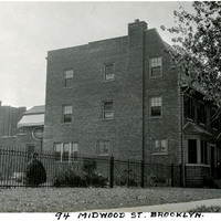
Caption: "94 Midwood St. Brooklyn." View of a three-story brick house or apartment building, with a park or empty lot on one side. See also 96-07-08-alb11-235, where the building is captioned as "The Walsh Home."
Date: 9/2/1934
-
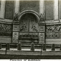
Caption: "Fountain of El Dorado" (Gertrude Vanderbilt Whitney, sculptor), within the West Colonnade of the Tower of Jewels at the Panama-Pacific International Exposition.
Date: 1915
-
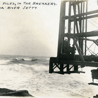
Caption: "Driving Piles in the Breakers, Columbia River Jetty." c. 1905.
Date: 1905
-
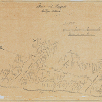
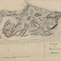
Hand-drawn sketch map of Agua Hedionda boundaries. Volume 1, page 772.
Date: 1841
-
-
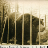
Caption: "Mascot Monarch Grizzly, G. G. Park," c. 1910. Captured in 1889, by a man hired by William Randolph Hearst as a publicity stunt, Monarch was one of the last known Grizzly bears in California. He lived in captivity for the last 22 years of his life, mostly in an enclosure in Golden Gate Park, before he died in 1911.
Date: 1910