
Bookmarks
Showing Bookmarks 1 to 2 of 2
-
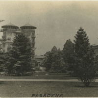
Caption: "Pasadena," c. 1915, shows the Hotel Green, built by George Gill Green in 1893, and expanded by him in 1898 and 1903 with two additional structures. The hotel complex was sold to private investors and by 1924, the 1898 Central Annex structure (Frederick L. Roehrig, architect) was turned into apartments and renamed the Castle Green. It is listed on the National Register of Historic Places, the California Register of Historic Places, and the City of Pasadena's list of historic places.
Date: 1915
-
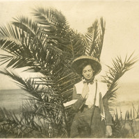
No caption. Unidentified woman standing in front of a palm at an unidentified location, c. 1908.
Date: 1908