

Bookmarks
Showing Bookmarks 1 to 7 of 7
-
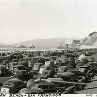
Caption: "Ocean Beach -- San Francisco, May 14, 1934." View of San Francisco's Ocean Beach, with a crowded parking lot in the foreground and the Cliff House (the fourth iteration of this San Francisco landmark) visible just to the right of the photograph's center. The date on this photograph may not be accurate, as several of the vehicles shown appear to date from later in the 1930s.
Date: 5/14/1934
-

Hand-drawn sketch map of Corral de Tierra boundaries. Volume 1, page 476.
Date: 1839
-
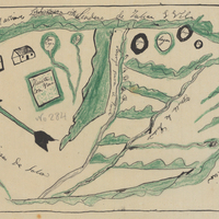
Hand-drawn sketch map of Boca de la Canada del Pinole boundaries. Volume 1, page 742.
Date: 1842
-

-

Hand-drawn sketch map of Punta de Cipress or Punta de Sepreses boundaries. Volume 1, page 84.
Date: 1843
-
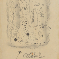
Hand-drawn sketch map of Conejo Rancho, or Nuesta Senora de Altagracia boundaries. Volume 1, page 324.
Date: 1834
-
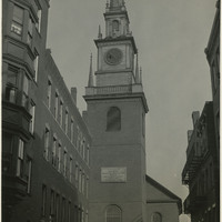
Caption: "Historic North Church, Boston. Where Signal was Hung for Paul Revere, Sept. 5, 1934." View of the clock tower and steeple of the Old North Church, built in 1723. The church is said to be the site where Paul Revere, after his famous midnight ride, caused two lanterns to be hung as the signal that British troops were advancing into the area by sea rather than by land.
Date: 9/5/1934