
Bookmarks
Showing Bookmarks 1 to 2 of 2
-
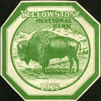
No Caption: A Yellowstone National Park decal, 1935, octagon-shaped, green and white, with an image of a buffalo in the foreground and mountain range in the background.
Date: 1935
-
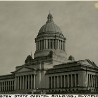
Caption: "Washington State Capitol Building, Olympia, Wash." c. 1935. The Neo-classical style building (Walter R. Wilder and Harry K. White, architects) opened in 1928, and was listed on the National Register of Historic Places in 1979.
Date: 1935