
Bookmarks
Showing Bookmarks 1 to 6 of 6
-

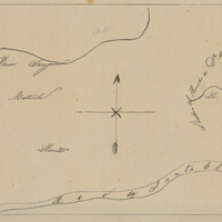
Hand-drawn sketch map of Pescadero or San Antonio boundaries. Volume 1, page 52.
Date: 1833
-
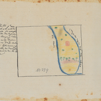
Hand-drawn sketch map of San Miguel or Sierritos boundaries. Volume 1, page 650.
Date: 1841
-
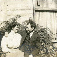
No Caption: Grace and William McCarthy sitting together at an unidentified location, c. 1906.
Date: 1906
-
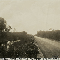
Caption: "Tamiami Trail Through the Florida Everglades, June 27, 1934." Asphalt-paved road stretching into the distance, flanked on one side by a canal. The Tamiami Trail constitutes a scenic portion of what is now U.S. Highway 41. Work on a road connecting Tampa with Miami began in 1915, but the Trail was not officially opened until 1928. Work on the route required building across a portion of the massive swamp system of the Everglades. Workers dredged and blasted a canal along the route, and used the fill dirt thus removed to construct the roadway proper.
Date: 6/27/1934
-
-

Caption: "George Washington Bridge, Crossing the Hudson River, N.Y. Sept. 3, 1934." This suspension bridge, designed by Othmar Ammann, spans the Hudson River between Manhattan in New York City, and Fort Lee, New Jersey. Constructed between 1927 and 1931, the bridge included the longest main span in the world at the time, a record it held until construction of the Golden Gate Bridge was completed in 1937. It was originally built with only one deck (as seen in this photograph), but a second deck opened in 1962. Still in active use today, it carried over 51 million vehicles in 2016.
Date: 9/3/1934