Bookmarks
Showing Bookmarks 1 to 6 of 6
-
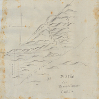
Hand-drawn sketch map of las Virgenes boundaries. Volume 1, page 110..
Date: 1833
-
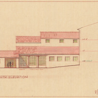
Caption: "South Elevation." Color drawing of postwar building, California School for the Deaf at Berkeley. Design and drawing by Alfred Eichler, 1944; built in 1946. Project for Department of Education.
Date: 1944
-
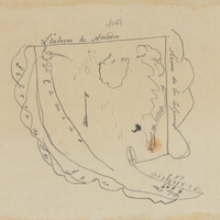
Hand-drawn sketch map of Palo Seco or Santa Rita boundaries. Volume 1, page 290.
Date: 1834
-
-
-