
Bookmarks
Showing Bookmarks 1 to 6 of 6
-
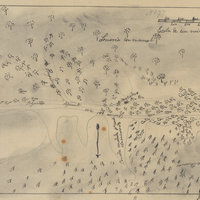
Hand-drawn sketch map of Canadita or Laguna Seca boundaries. Volume 1, page 168.
Date: 1833
-
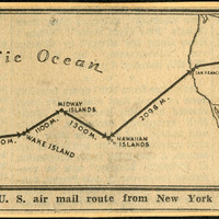
No caption. Clipping from an unidentified newspaper or pamphlet entitled "Route of U.S. air mail route from New York to Macao." It shows an airmail route traveling from New York, west across the U.S. to the Hawaiian Islands, then to "Midway Islands," Wake Island, Guam, "Philippine Islands", and finally Macao, China.
Date: Undated
-
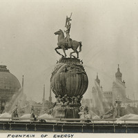
Caption: "Fountain of Energy," (A. Stirling Calder, sculptor), at the Panama-Pacific International Exposition. See also 96-07-08-alb01-015.
Date: 1915
-
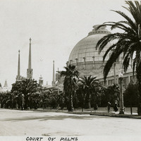
Caption: "Court of Palms," at the Panama-Pacific International Exposition. See also 96-07-08-alb01-059 with caption: "Palm Avenue."
Date: 1915
-
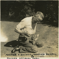
Caption: "Feeding a Golden Mantled Squirrel Rainier National Park," c. 1935, shows William McCarthy feeding the wildlife at Mt. Rainier National Park.
Date: 1935
-
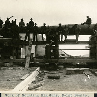
Caption: "Work of Mounting Big Guns, Point Benito [sic]," c. 1906. This may actually be Point Bonita in the San Francisco Bay.
Date: 1906