
Bookmarks
Showing Bookmarks 1 to 3 of 3
-
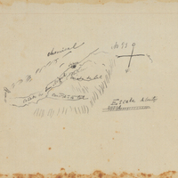
Hand-drawn sketch map of Cañada de San Miguel boundaries. Volume 1, page 202.
Date: 1834
-
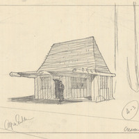
Caption: "Crescent City." Design and drawing of plant quarantine inspection station by Alfred Eichler. Built in 1936. Project for Department of Agriculture.
Date: 1931
-
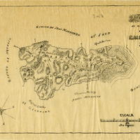
Hand-drawn sketch map of Gallinas y Santa Margarita or San Pedro boundaries. Volume 2, page 40.
Date: 1844