Bookmarks
Showing Bookmarks 1 to 5 of 5
-
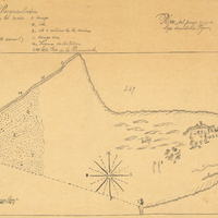
Hand-drawn sketch map of Santa Margarita boundaries. Volume 1, page 672.
Date: 1840
-

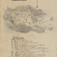
Hand-drawn sketch map of San Miguelito boundaries. Volume 1, page 296.
Date: 1839
-
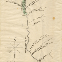
Hand-drawn sketch map of Cañada de Capay boundaries. Volume 2, page 96.
Date: 1844
-
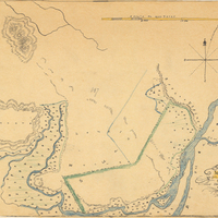
Hand-drawn sketch map of Bidwell's Rancho boundaries. Volume 2, page 72.
Date: 1844
-