
Bookmarks
Showing Bookmarks 1 to 3 of 3
-
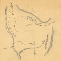
Hand-drawn sketch map of Land-valley of Temecula boundaries. Volume 2, page 83.
Date: 1844
-
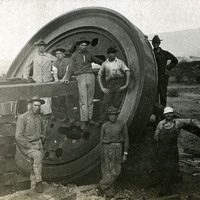
No caption, c. 1909-1915. Group of unidentified men gathered around a part of what appears to be a 12-inch mortar at Fort Ruger, Hawaii. Fort Ruger was established on the Island of O'ahu by the U.S. in 1906 as the Diamond Head Reservation. Its name was changed to Fort Ruger in 1909. See also 96-07-08-alb05-098 and 100.
Date: 1915
-
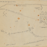
Hand-drawn sketch map of San Pedro y San Pablo boundaries. Volume 1, page 442.
Date: 1839