
Bookmarks
Showing Bookmarks 1 to 2 of 2
-

-
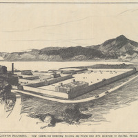
Caption: "New Prison for Segregation of San Quentin Prisoners. View Showing New Dormitory and Prison Yard with Relation to Existing Prison. Mt. Tamalpais in Background." Drawing by Alfred Eichler, September 26, 1934. Project for Department of Corrections.
Date: 1934