

Bookmarks
Showing Bookmarks 1 to 11 of 11
-
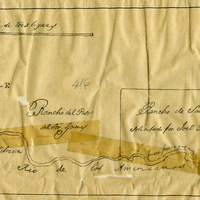
Hand-drawn sketch map of Rancho Del San Juan or San Juan boundaries. Volume 2, page 100.
Date: 1844
-
-
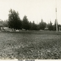
Caption: "Fort Townsend," c. 1906. Park-like scene, with buildings in the distance and a flag pole at the right. The U.S. Army established Fort Townsend in 1856. Abandoned after a fire destroyed the barracks buildings in 1895, it was reactivated during World War II to serve as a munitions defusing station. It was turned over to the State of Washington in 1953, and is now in use as Fort Townsend State Park.
Date: 1906
-

Caption: "San Diego Fair Grounds." and "39-9, U.S. Naval Training Station, Balboa Park, San Diego," c. 1917. With the advent of World War I, the U.S. Navy needed additional training grounds for sailors. In 1917, the City of San Diego offered to lease the Navy a portion of Balboa Park as a temporary training site until a new, more permanent facility could be constructed. This postcard shows groups of sailors drilling in formation while a small crowd watches.
Date: 1917
-

-
-
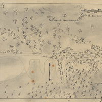
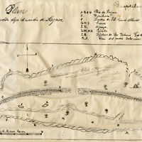
Hand-drawn sketch map of Canadita or Laguna Seca boundaries. Volume 1, page 168.
Date: 1833
-
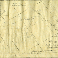
Hand-drawn sketch map of San Francisco de las Llagas boundaries. Volume 1, page 42.
Date: 1833
-
-
-
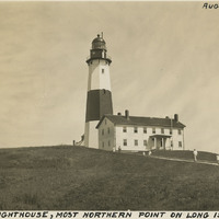
Caption: "Montauk Lighthouse, Most Northern Point on Long Island, N.Y., Aug. 18, 1934." The Montauk Lighthouse, first lit in 1797, was the first lighthouse built in New York. Ezra L'Hommedieu designed the building as well as choosing its site on the eastern edge of Long Island. A renovation in 1860 raised the lighthouse to its current height of more than 110 feet. A larger lantern was installed at that time as well. Electrified in 1940, it is now a National Historic Landmark as well as an active lighthouse.
Date: 8/18/1934