
Bookmarks
Showing Bookmarks 1 to 4 of 4
-
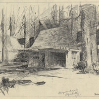
Caption: "Border Station. Crescent City." Design and drawing of plant quarantine inspection station by Alfred Eichler. Built in 1936. Project for Department of Agriculture.
Date: 1931
-
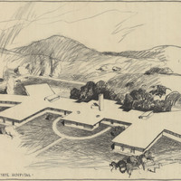
Drawing of tubercular units, Napa State Hospital. Design by R. D. Murray, drawing by Alfred Eichler. Built. Project for Department of Mental Hygiene - Hospitals.
Date: 1941
-
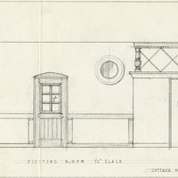
Caption: "Visiting Room, Cottage #11, Stockton Farm." Stockton State Hospital. Design and drawing by Alfred Eichler. Project for Department of Mental Hygiene - Hospitals.
Date: 1935
-
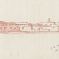
Caption: "Sketch of Ward Building, Stockton State Hospital." Design and drawing by Alfred Eichler. Built in 1946. Project for Department of Mental Hygiene - Hospitals.
Date: 1940