Skip to Main Content
CA.gov
Archives Home
Facebook
Youtube
My Bookmarks
Default
High Contrast
Reset
Increase Font Size
Font
Increase
Decrease Font Size
Font
Decrease
Dyslexic Font
California Secretary of State
Shirley N. Weber, Ph.D.
Menu
Home
Search Items
Browse Collections
About
Home
My Bookmarks
Bookmarks
Showing Bookmarks 1 to 2 of 2
Clear Bookmarks
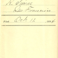
Old Series Trademark No. 2485
Remove
P. L. monogram, Prof. Lazarus' Pile ointment
Date: 1894
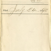
Old Series Trademark No. 1865a
Remove
49er
Date: 1890
First
<
1
>
Last