
Bookmarks
Showing Bookmarks 1 to 9 of 9
-
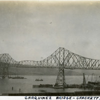
Caption: "Carquinez Bridge -- Crockett, Cal." This photograph shows the original Carquinez Bridge, built to span the Carquinez Strait and thereby contribute to a direct route between Sacramento and San Francisco. The steel cantilevered bridge, designed by Robinson & Steinman, was constructed in 1927. It is no longer extant, having been replaced by two parallel bridges constructed in 1958 and 2003. The structure of the original bridge was removed in 2007. See also 96-07-08-alb11-307 with caption: "Carquinez Bridge, Crockett, California. Oct. 9, 1934."
Date: 10/9/1934
-
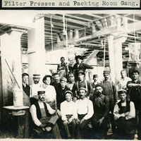
Caption: "Filter Presses and Packing Room Gang," c. 1906, shows a group of unidentified men posing for a photograph in the packing room at the Crockett Sugar Mill.
Date: 1906
-
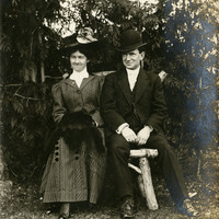
No Caption: c. 1906. William and Grace McCarthy seated on a wood branch bench in a park or garden.
Date: 1906
-
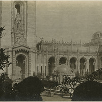
No Caption: Court of Abundance at the Panama-Pacific International Exposition.
Date: 1915
-
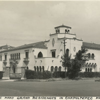
Caption: "One of the many grand residences in Chapultepec Heights, Mexico City."
Date: 1938
-
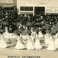
Caption: "Portola Celebration." 1909. The Portola Festival was a grand celebration devised to commemorate the discovery of San Francisco Bay by Gaspar De Portola, and for the public to celebrate the future of the rebuilt city after the 1906 earthquake and fires.
Date: 1909
-
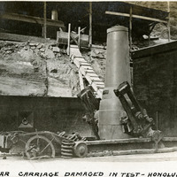
Caption: "Mortar Carriage Damaged in Test - Honolulu," c. 1906.
Date: 1906
-
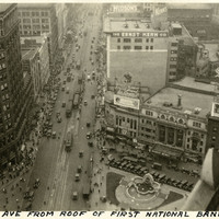
Caption: "Woodward Ave From Roof of First National Bank Bldg. - Detroit," c. 1925. Bird's eye view of a bustling street scene along Detroit's Woodward Ave.
Date: 1925
-
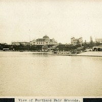
Caption: "View of Portland Fair Grounds." This photograph shows a panoramic view of the fair grounds where the Lewis and Clark Centennial Exposition was held in Portland, Oregon, from June 1st to October 15th, 1905. The international exposition celebrated the one-hundred year anniversary of the exploratory expedition of the Louisiana Purchase and what became the northwestern part of the United States, led by Meriwether Lewis and William Clark. Some 1.6 million people visited the fair, viewing exhibits from twenty-one countries.
Date: 1905