
Bookmarks
Showing Bookmarks 1 to 6 of 6
-
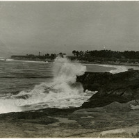
No Caption: c. 1910. Ocean shore scene with waves and high spray, with a promontory in the distance featuring several buildings. The Vue de L'eau (View of the Water) was a station on the Santa Cruz, Garfield Park and Capitola Electric Railway electric streetcar line. Built in 1891, the station was located at the very end of the line, on a promontory overlooking the Pacific Ocean. It featured an observatory on the top story. The same company also built a casino, ballroom, and restaurant nearby. The station burned down in 1925. See also 96-07-08-alb05-159.
Date: 1910
-
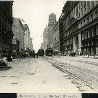
Caption: "Building up on Market Street," c. 1907. A view of Market Street repairs one year after the 1906 earthquake and fires.
Date: 1907
-
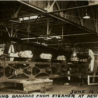
Caption: "Unloading Bananas from Steamer at New Orleans, June 16 34." Conveyor belt, and workers unloading bunches of bananas from a cargo ship.
Date: 6/16/1934
-
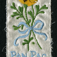
No Caption: A small white commemorative bookmark with embroidered golden poppies tied with blue ribbon and blue lettering: "Pan. Pac. Int. Exp. 1915."
Date: 1915
-
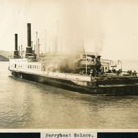
Caption: "Ferryboat Solano," c. 1906. The Solano was a large railroad ferry that operated across the Carquinez Straight between Benicia and Port Costa in California.
Date: Undated
-
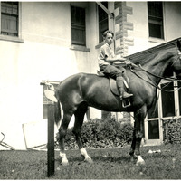
No caption. Young unidentified boy seated on a horse saddled with English tack in front of the John Shields residence in the Daybreak Estate area of Long Island.
Date: 1934