
Bookmarks
Showing Bookmarks 1 to 5 of 5
-
-
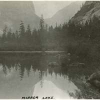
Caption: "Mirror Lake," c. 1917. Mirror Lake in Yosemite National Park, on Tenaya Creek, is the remains of a glacial lake that used to fill most of the valley. Its calm waters provide near-perfect reflections of the surrounding natural splendor.
Date: 1917
-
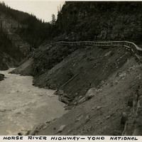
Caption: "Kicking Horse River Highway - Yoho National Park. British Columbia, Canada," c. 1935.
Date: 1935
-
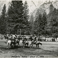
Caption: "Potato Race - July 4, 1917." Several horseback riders holding long poles skirmish in what appears to be a game similar to polo, played with a potato. A crowd has gathered to watch the game, while the rock cliff walls of Yosemite Valley tower in the background. Given the date, this was likely part of Independence Day festivities in the Yosemite Valley.
Date: 7/4/1917
-
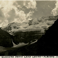
Caption: 'Victoria Glaciers above Lake Louise - Alberta, Canada," c. 1935.
Date: 1935