
Bookmarks
Showing Bookmarks 1 to 8 of 8
-
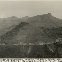
Caption: "Highway leaving Tamazunchale where the real climb into the Sierra Madre mountains begins - 170 miles to highest point - 8200 ft. elevation."
Date: 1938
-
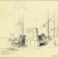
Caption: "Historic Landmark Sign, Division of Highways." Design by Alfred Eichler. These signs were created throughout the state of California. Project for Department of Natural Resources - Beaches and Parks.
Date: 1947
-
-
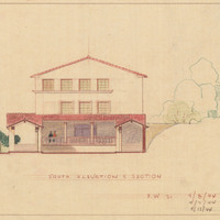
Caption: "South Elevation and Section." Color drawing of postwar building, California School for the Deaf at Berkeley. Design and drawing by Alfred Eichler, 1944; built in 1946. Project for Department of Education.
Date: 1944
-
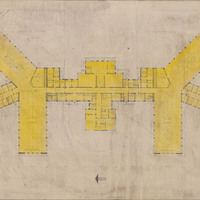
Caption: "Floor Plan." Perspective drawing of floor plan, tubercular units, Napa State Hospital, by Alfred Eichler. Design by R. D. Murray, 1941. Built. Project for Department of Mental Hygiene - Hospitals.
Date: 1941
-
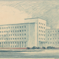
Caption: "Education Building - The Mall - Sacramento, Calif." Alfred Eichler, supervising architect of design; from working drawings by Harry Devine, Architect. Built in 1950. Project for Department of Finance - Buildings and Grounds - Office Buildings.
Date: 1949
-
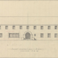
Caption: "Front Elevation East." Revision. On label: "Acute Disturbed Females, Stockton." Design and drawing of Acute Disturbed Ward, Stockton State Hospital, by Alfred Eichler. Built. Project for Department of Mental Hygiene - Hospitals.
Date: 1937
-
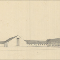
Design and drawing of unidentified building by Alfred Eichler. Project for Department of Mental Hygiene - Hospitals.
Date: undated