
Bookmarks
Showing Bookmarks 1 to 3 of 3
-
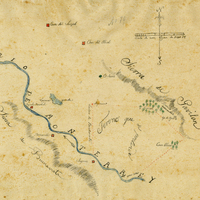
Hand-drawn sketch map of Buena Esperanza boundaries. Volume 1, page 206.
Date: 1833
-
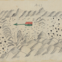
Hand-drawn sketch map of Quien Sabe boundaries. Volume 1, page 286.
Date: 1839
-
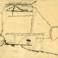
Hand-drawn sketch map of San Ramon boundaries. Volume 1, page 174.
Date: 1833