Bookmarks
Showing Bookmarks 1 to 11 of 11
-
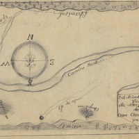
Hand-drawn sketch map of Corral de Tierra boundaries. Volume 1, page 230.
Date: 1834
-
Caption: "Barracks No. 7 Veterans Home Yountville. State Dept. of Public Works Division of Architecture, Geo B. McDougall State Architect." Design and drawing by Alfred Eichler. Built. Barracks named "Theodore Roosevelt." Project for Department of Veterans Affairs.
Date: 1937
-
-
Caption: "Scene on the Placerville Highway." Grace McCarthy standing near an automobile on the side of an unpaved road, today's U.S. Route 50, east of Placerville.
Date: 1927
-
Hand-drawn sketch map of Carte de Madera del Presidio or San Clemente boundaries. Volume 1, page 56.
Date: 1834
-
J. H. Cutter's Bourbon Whiskey. All paperwork missing save the enclosing envelope.
Date: 1881
-
No Caption: Grace and William McCarthy sitting together at an unidentified location, c. 1906.
Date: 1906
-
-
Caption: "Review, Fort Worden.," c. 1908-1912. Shows a military band playing or preparing to play, with rows of troops assembled in the background on the right side of the photograph. Fort Worden is located in Port Townsend, Washington, on Admiralty Inlet of Puget Sound. Construction began on the fort in 1898, and by 1902 it was serving as an active U.S. Army base. Fort Worden was part of the "triangle of fire," three coastal defense fortifications (Fort Casey, Fort Worden, and Fort Flagler) guarding the entrance to Puget Sound. The U.S. sold the property to the State of Washington in 1957. In 1973, the fort and surrounding area opened as Fort Worden State Park.
Date: 1908
-
-
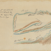
Hand-drawn sketch map of Jalapa or Napa boundaries. Volume 1, Page 532.
Date: 1837