

Bookmarks
Showing Bookmarks 1 to 25 of 52
-

Hand-drawn sketch map of Sanjones, or Zanjones boundaries. Volume 1, page 440.
Date: 1839
-
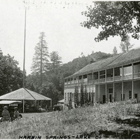
Caption: "Harbin Springs -- Lake Co," c. 1920. Resort buildings at Harbin Springs, home of the Harbin Hot Springs.
Date: 1920
-

-
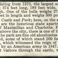
No Caption: A section from an informational tourist brochure describing the Cathedral and Chapultepec Castle and Park in Mexico City.
Date: 1938
-

-

-
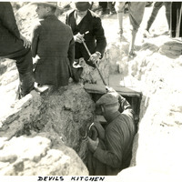
Caption: "Devil's Kitchen," c. 1923. This photograph shows several people descending into and standing around the entry to Devil's Kitchen, an extinct hot spring that left behind a cavern. Once a popular tourist attraction for its small opening that made visitors feel as if they were descending into the underworld, the site was closed in 1939 because the cavern periodically fills with dangerous levels of carbon dioxide.
Date: 1923
-
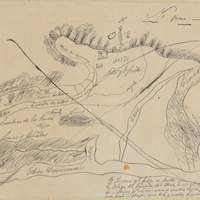
Hand-drawn sketch map of Estero Americano or Cañada de Mais boundaries. Volume 1, page 452.
Date: 1837
-

-
-

-

Correspondence from Azile H. Aaron to Martha A. Chickering regarding the manual and clarification on policy
Date: March 3, 1942
-

-
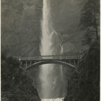
No Caption: A view of the Multnomah Falls on the Oregon side of the Columbia River, c. 1935.
Date: 1935
-
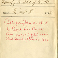
Red Seal, Our Charter, Pacific Coast Co-operative Cigar Manufacturing. Co
Date: 1888
-
-
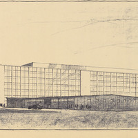
Caption: "DMV Office Bldg. #2, Sacto." Drawing and preliminary design of Headquarters Office Building #2, Department of Motor Vehicles, by Alfred Eichler. Preliminary design by Alfred Eichler, 1960. Project for Department of Motor Vehicles.
Date: 1960
-
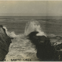
Caption: "Ver De Leu [sic], Santa Cruz", c. 1910. Ocean shore scene with rocks, waves, and high spray. The Vue de L'eau (View of the Water) was a station on the Santa Cruz, Garfield Park and Capitola Electric Railway electric streetcar line. The station, built in 1891, was located at the very end of the line, on a promontory overlooking the Pacific Ocean. It featured an observatory on the top story. The same company also built a casino, ballroom, and restaurant nearby. The station burned down in 1925. See also 96-07-08-alb05-079.
Date: 1910
-
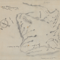
Hand-drawn sketch map of Lauguna de los Palos Colorados boundaries. Volume 1, page 666.
Date: 1834
-
The Census of 1852 collection includes enumerations of California's 32 counties, arranged into 126 volumes. Schedule I enumerated the county's inhabitants, while schedule II enurmerated economic production. Many pages of this volume are damaged.
Date: 1852
-

Memorandum from Warren Olney regarding payment of wages to Japanese nationals
Date: December 10, 1941
-

Correspondence from Earl Warren (by Warren Olney) to J. A. Greening regarding arrests of Japanese relinquishing firearms and cameras; Response to R177_086_182-32_001a-R177_086_182-32_001b
Date: December 23, 1941
-
-
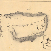
Hand-drawn sketch map of Land-Los Angeles boundaries. Volume 2, page 175.
Date: 1839
-
