
Bookmarks
Showing Bookmarks 1 to 2 of 2
-
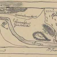
Hand-drawn sketch map of Rinconada del Arroyo de San Francisquito boundaries. Volume 1, page 596.
Date: 1838
-
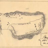
Hand-drawn sketch map of Land-Los Angeles boundaries. Volume 2, page 175.
Date: 1839