

Bookmarks
Showing Bookmarks 1 to 6 of 6
-
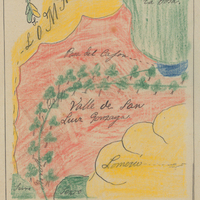
Hand-drawn sketch map of Valle de San Luis Gonzaga boundaries. Volume 1, page 652.
Date: 1840
-

Hand-drawn sketch map of Camaritas boundaries. Volume 1, page 508.
Date: 1839
-
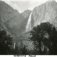
Caption: "Yosemite Falls," c.1917. Both the Upper and Lower Yosemite Falls, on Yosemite Creek, are visible in this photograph, taken from the valley floor. The highest waterfall in Yosemite National Park, Yosemite Falls is made up of two successive cascades falling a total of 2,425 feet from the top of the Upper Fall to the base of the Lower Fall. The Upper Fall alone is 1,430 feet high, and is one of the top twenty highest waterfalls in the world.
Date: 1917
-
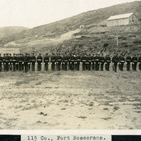
Caption: "115 Co., Fort Rosecrans.," c. 1905. View of the 115th Company of the U.S. Army Coast Artillery Corps, standing in formation. The 115th was formed at the San Diego Barracks in 1901 and subsequently moved to Fort Rosecrans on Point Loma near San Diego. They remained at the fort until 1924 when the company was moved to Puget Sound in Washington.
Date: 1905
-

Caption: "Solitary Geyser-Yellowstone National Park," c. 1935.
Date: 1935
-
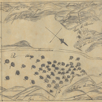
Hand-drawn sketch map of Ojo de Agua de la Coche boundaries. Volume 1, page 60.
Date: 1835