
Bookmarks
Showing Bookmarks 1 to 2 of 2
-
-
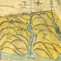
Hand-drawn sketch map of Corral de Tierra boundaries. Volume 1, page 230.
Date: 1834