
Bookmarks
Showing Bookmarks 1 to 3 of 3
-
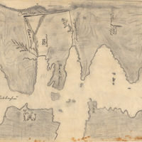
Hand-drawn sketch map of San Clemente or Tamalpais boundaries. Volume 2, page 122.
Date: 1845
-
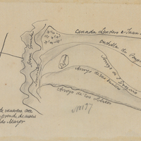
Hand-drawn sketch map of San Francisquito or San Gregorio boundaries. Volume 1, page 526.
Date: 1839
-
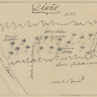
Hand-drawn sketch map of Rincon or Matilija boundaries. Volume 1, page 370.
Date: 1834