Bookmarks
Showing Bookmarks 1 to 10 of 10
-
Hand-drawn sketch map of Land- Mission San Buenaventura boundaries. Volume 2, page 138.
Date: 1845
-
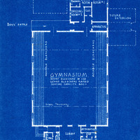
Caption: "Floor Plan. Gymnasium, Whittier State School." Blueprint, Fred C. Nelles School for Boys; design and drawing by Alfred Eichler. Project for California Youth Authority - Institutions.
Date: 1934
-
-
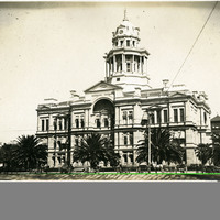
No Caption: San Joaquin County Courthouse (E.E. Myers, architect), Stockton, California, c. 1906. The neoclassical building was completed in 1890 and demolished in 1961 to make way for a new courthouse.
Date: 1906
-
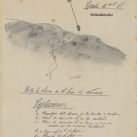
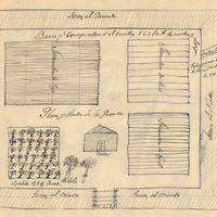
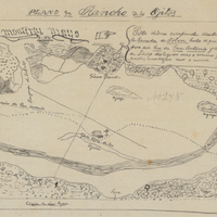
Hand-drawn sketch map of Cañada de los Osos y Pecho y Islae boundaries. Volume 1, page 700.
Date: 1842
-
-
-
-
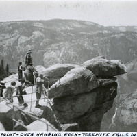
Caption: "Glacier Point - Over Hanging Rock - Yosemite Falls In The Distance," c. 1935. A group of unidentified people looking out from Glacier Point. Both Upper and Lower Yosemite Fall are visible across the valley at the right side of the photograph. Glacier Point, on the south wall of the valley 3,200 feet above what is now known as Half Dome Village, provides panoramic views of the valley and many of its features. By the time this photograph was taken, safety railings had been installed at the Point to prevent visitors from tumbling over the cliff while trying to get the best views.
Date: 1935
-