Bookmarks
Showing Bookmarks 1 to 13 of 13
-
-
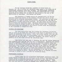
Review of War Services in Tulare County; Sections: Civilian War Assistance, Resettlement Assistance
Date: January 15, 1946
-
-
-
-
-
Morning Comfort Punch, Anti-Dyspectic Punch, Anti-Divorce Punch, etc.
Date: 1864
-
-
-
-
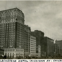
Caption: "Blackstone Hotel -- Michigan Av. Chicago," c. 1923. Built in 1909 and designed by Benjamin Marshall, the twenty-one story Blackstone Hotel sits on the corner of Michigan Avenue and Balbo Drive in Chicago Illinois. It is the building closest to the left side of the photograph in this row of high-rises. See also 96-07-08-alb09-092.
Date: 1923
-
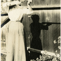
Caption: "A Holdup," c. 1910. Grace McCarthy standing in a yard or garden aiming a rifle at an unseen target.
Date: 1910
-