Bookmarks
Showing Bookmarks 1 to 5 of 5
-
-
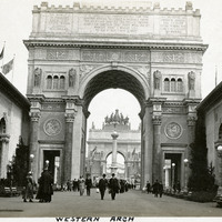
Caption: " Western Arch," at the Panama-Pacific International Exposition.
Date: 1915
-
-
-