Red Brand
Date: 1885
Jay-Eye-See
Date: 1883
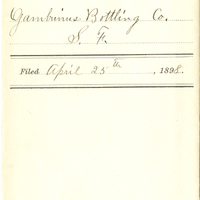
Gambrinus Bottling Co.
Date: 1898
Dr. Henley's IXL Bitters
Date: 1870