Search All Items
- Filters:
- Type
- Image 1473
- Still Image 304
- Text 72
- Text 19
- Language
- English 1654
- Spanish 215
- ENGLISH 2
- English 1
- census_013 1
Search Results 1121 to 1130 of 1881
-
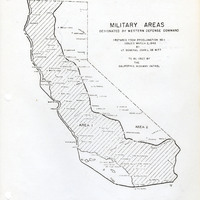
Map of California indicating boundaries for military areas prepared from Proclamation No. 1, issued by Lt. General John L. DeWitt to the California Highway Patrol
Date: Issued March 2, 1942
-
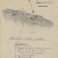
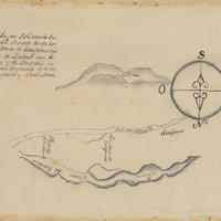
Hand-drawn sketch map of Cañada de los Osos y Pecho y Islae boundaries. Volume 1, page 700.
Date: 1842
-
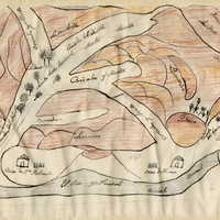
Hand-drawn sketch map of Laguna de las Calbazas boundaries. Volume 1, page 262.
Date: 1833
-
Hand-drawn Sketch map of Punta del Monte boundaries. Volume 1, page 164.
Date: 1834
-
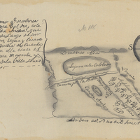
Hand-drawn sketch map of Land at Buenaventura boundaries. Volume 2, page 134.
Date: 1845