Search All Items
- Filters:
- Type
- Still Image 4044
- Image 3895
- Text 436
- Text 50
- Image of the California Census from the records of the office of the California Secretary of State 1
- Language
- English 7938
- Spanish 494
- ENGLISH 4
- English 2
- census_013 1
- contra_costa_schedule_1_volume_1 1
Search Results 1741 to 1750 of 8604
-
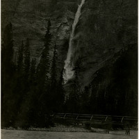
Caption: "Takakkaw Falls 3500 ft. high. Yoho National Park, Canada," c. 1935.
Date: 1935
-
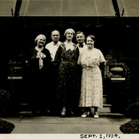
Caption: "Sept. 1, 1934." Grace McCarthy (center) posing with Jim Walsh (second from the right), his wife (far right), and two unidentified individuals, in front of a covered patio.
Date: 9/1/1934
-
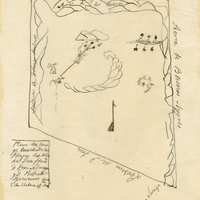
Hand-drawn sketch map of Positas del Valle de San Jose boundaries. Volume 1, page 292.
Date: 1834