Search All Items
- Filters:
- Type
- Still Image 4044
- Image 3895
- Text 436
- Text 50
- Image of the California Census from the records of the office of the California Secretary of State 1
- Language
- English 7938
- Spanish 494
- ENGLISH 4
- English 2
- census_013 1
- contra_costa_schedule_1_volume_1 1
Search Results 2081 to 2090 of 8604
-
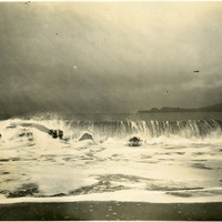
No Caption: See also 96-07-08-alb03-097 with caption: "Wave on Bakers Beach Presidio," San Francisco, California, c. 1906.
Date: 1906
-
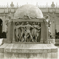
No Caption: Fountain of the Earth (Robert I. Aitken, sculptor), in the Court of Abundance, at the Panama-Pacific International Exposition.
Date: 1915
-
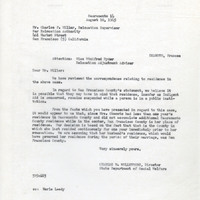
Correspondence from Charles M. Wollenberg to Charles F. Miller regarding residency of Frances Okamoto
Date: August 10, 1945
-
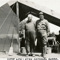
Caption: "Camp Life -- Utah National Guard.," c. 1915-1920. Two Utah National Guardsmen standing in front of tent at an unidentified location.
Date: 1920
-
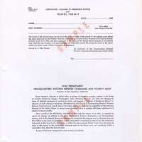
Notice indicating the requirement for aliens to acquire Certificates of Identification; signed Earl G. Harrison and Francis Biddle; Attachment: "Summary of Proclamation of the President of the United States…" (F3729_144_002b)
Date: Undated
-
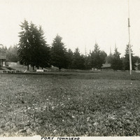
Caption: "Fort Townsend," c. 1906. Park-like scene, with buildings in the distance and a flag pole at the right. The U.S. Army established Fort Townsend in 1856. Abandoned after a fire destroyed the barracks buildings in 1895, it was reactivated during World War II to serve as a munitions defusing station. It was turned over to the State of Washington in 1953, and is now in use as Fort Townsend State Park.
Date: 1906
-
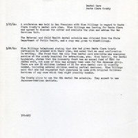
Summary of communications with Miss Billings regarding dental care in Santa Clara County
Date: March 25-28, 1946
-
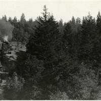
No Caption. A view of a train crossing over trestle at an unidentified location, c. 1910.
Date: 1910
-
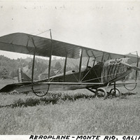
Caption: "Aeroplane -- Monte Rio,, Calif.," c. 1915. Biplane parked in a field, with an unidentified man on crutches nearby.
Date: 1915