Search All Items
- Filters:
- Type
- Image 1263
- Still Image 122
- Text 93
- Text 19
- Language
- English 1450
- Spanish 48
- ENGLISH 2
- English 1
- census_013 1
Search Results 191 to 200 of 1517
-
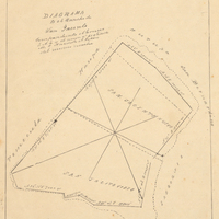
Hand-drawn sketch map of Potrero or San Jacinto Nuevo y Potrero or San Jacinto Sobrante boundaries. Volume 2, page 157.
Date: 1845
-
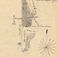
Hand-drawn sketch map of Mission Vieja de la Purisima or Valle de los Palmas boundaries. Volume 2, page 149.
Date: 1845
-
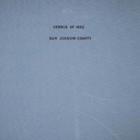
The Census of 1852 collection includes enumerations of California's 32 counties, arranged into 126 volumes. Schedule I enumerated the county's inhabitants, while schedule II enurmerated economic production. Many pages of this volume are damaged.
Date: 1852