Search All Items
- Filters:
- Language
- English 7958
- Spanish 495
- ENGLISH 4
- English 2
- census_013 1
- contra_costa_schedule_1_volume_1 1
- Type
- Still Image 4047
- Image 3895
- Text 451
- Text 54
- Textual 2
- Image of the California Census from the records of the office of the California Secretary of State 1
Search Results 2571 to 2580 of 8628
-
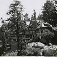
No Caption: An unidentified hotel in Yosemite National Park, C. 1935.
Date: 1935
-
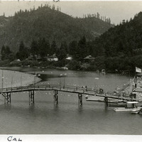
Caption: "Monte Rio Cal," c. 1906. Scene on the Russian River with wharf at right, some houses along the river bank in the distance, and a wooden footbridge crossing the river. Monte Rio, north of San Francisco in Sonoma County, became a resort area in the early twentieth century, after the sawmills providing the area's primary industry closed down.
Date: 1906
-
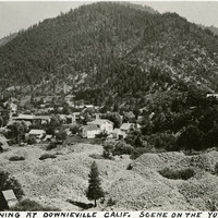
Caption: "Gold Mining at Downieville, Calif. Scene on the Yuba River," c. 1920. Small town nestled at foot of mountain, with gravel piles in foreground. Downieville was settled in 1849 during the California Gold Rush.
Date: 1920
-
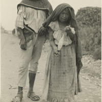
Caption: "Old Otomie [sic]Indian lady and her son. She is spinning twine from Maguey fiber onto a spool as she trudges the highway barefooted, Zimipan, Mexico."
Date: 1938
-
Caption: "Old State Capitol-Benicia," c. 1918, shows the Benicia State Capitol building, built in 1852, the third location of the state capital from February 1853 to February 1854, before it was moved permanently to Sacramento. The historic building was listed as a California State Historic Landmark in 1935, and added to the National Register of Historic Places in 1971. Today the site is known as the Benicia Capitol State Historic Park.
Date: 1918
-
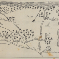
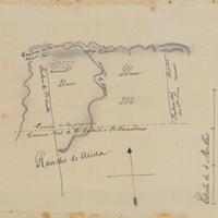
Hand-drawn sketch map of Rincon de San Francisquito boundaries. Volume 1, page 624.
Date: 1841