Search All Items
- Filters:
- Language
- English 7958
- Spanish 495
- ENGLISH 4
- English 2
- census_013 1
- contra_costa_schedule_1_volume_1 1
- Type
- Still Image 4047
- Image 3895
- Text 451
- Text 54
- Textual 2
- Image of the California Census from the records of the office of the California Secretary of State 1
Search Results 5401 to 5410 of 8628
-
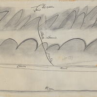
Hand-drawn sketch map of Cañada del Portezuela boundaries. Volume 1, page 530.
Date: 1837
-
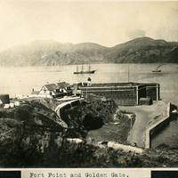
Caption: "Fort Point and Golden Gate," c. 1906. Fort Point in the foreground, with ships in the bay. Fort Point was part of an effort by the U.S. government to protect the Golden Gate, entrance to the San Francisco Bay. Built between 1853-1861 of brick and mortar, the fort included emplacements for 141 guns but never fired a weapon in defense of the Bay.
Date: 1906