Search All Items
- Filters:
- Type
- Still Image 4044
- Image 3895
- Text 436
- Text 50
- Image of the California Census from the records of the office of the California Secretary of State 1
- Language
- English 7938
- Spanish 494
- ENGLISH 4
- English 2
- census_013 1
- contra_costa_schedule_1_volume_1 1
Search Results 561 to 570 of 8604
-
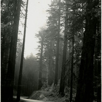
Caption: "Redwood Highway near Crescent City," c. 1935. U.S. Route 101, or the Redwood Highway as it is known in northern California, was established in 1926. It is also known as El Camino Real (The Royal Road) along the southern and central California Coast and approximates the old trail that linked the missions, pueblos, and presidios of the Spanish era.
Date: 1935
-
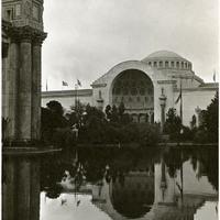
Caption: "The Lagoon," near the Palace of Fine Arts at the Panama-Pacific International Exposition
Date: 1915
-
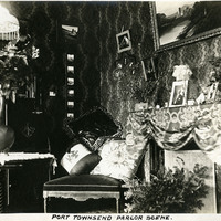
Caption: "Port Townsend Parlor Scene.," c. 1908-1912. View of a parlor in a Port Townsend residence.
Date: 1908
-
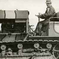
No caption, c. 1917. William McCarthy in the driver's seat of a small, camouflaged tank or other military transport, with a caterpillar-style propulsion system. The photograph was likely taken at Camp Kearney.
Date: 1917
-
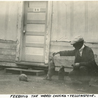
Caption: "Feeding the Wood Chucks [sic]- Yellowstone," c. 1923. William McCarthy crouches down to feed an eager groundhog balancing on his hind legs in this photograph.
Date: 1923
-
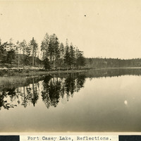
Caption: "Fort Casey Lake, Reflections.," c. 1908-1912. Peaceful scene at Crocket Lake near Fort Casey, the water so still that the trees and surrounding hills are clearly reflected in the lake's waters.
Date: 1908
-
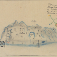
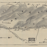
Hand-drawn sketch map of Biedra Blanca boundaries. Volume 1, page 506.
Date: 1839
-
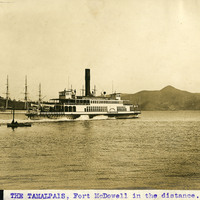
Caption: "The Tamalpais, Fort McDowell in the distance," c. 1910. The single stack steamer, Tamalpais, cruising on the waters of the San Francisco Bay. Fort McDowell, seen in the distance, is located on Angel , today part of the California State Park system.
Date: 1910
-
Hand-drawn sketch map of Espiritu Santos Lomos Del or Lomeritas Muertas boundaries. Volume 1, page 762.
Date: 1841
-
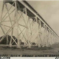
Caption: "Mississippi River Bridge Under Construction, New Orleans, June 14, 1934." View of the Huey P. Long Bridge while under construction. The cantilevered steel through truss bridge, designed by Ralph Modjeski, spans the Mississippi River between Elmwood and Bridge City. It opened to traffic in 1935.
Date: 6/14/1934