Search All Items
- Filters:
- Type
- Still Image 4044
- Image 3895
- Text 436
- Text 51
- Image of the California Census from the records of the office of the California Secretary of State 1
- Language
- English 7939
- Spanish 494
- ENGLISH 4
- English 2
- census_013 1
- contra_costa_schedule_1_volume_1 1
Search Results 6201 to 6210 of 8605
-
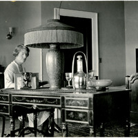
No caption: Grace McCarthy seated at a desk reading a book, in the guest room of a residence in the Daybreak Estate area of Long Island. See also 96-07-08-alb11-222.
Date: 8/21/1934
-
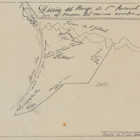
Hand-drawn sketch map of Rincon de San Pascual boundaries. Volume 1. page 564.
Date: 1840
-
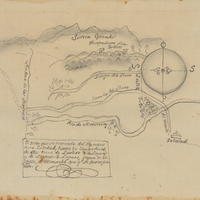
Hand-drawn sketch map of Punta del Monte, or Rincon de la Monte, or Rincon del la Punta de Monte de la Soledad boundaries. Volume 1, page 140.
Date: 1836
-
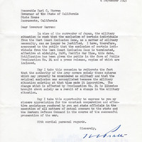
Correspondence from H. C. Pratt to Earl Warren regarding the termination of exclusion of certain individuals from the West Coast Exclusion Zone
Date: September 4, 1945
-
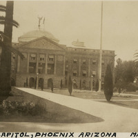
Caption: "State Capitol, Phoenix Arizona, May 24, 34." View of the façade of the Arizona State Capitol Building in Phoenix. Designed by James Riely Gordon, the building opened for use in 1901.
Date: 5/24/1934