Search All Items
- Filters:
- Language
- English 7958
- Spanish 495
- ENGLISH 4
- English 2
- census_013 1
- contra_costa_schedule_1_volume_1 1
- Type
- Still Image 4047
- Image 3895
- Text 451
- Text 54
- Textual 2
- Image of the California Census from the records of the office of the California Secretary of State 1
Search Results 6291 to 6300 of 8628
-
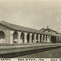
Caption: "Santa Fe Depot. San Diego, Cal, July 18, 1915," shows the Santa Fe Depot (Arthur Brown Jr, architect), in the Mission Revival architectural style. The train station opened in March 1915 to accommodate the crowds expected to visit the Panama-California Exposition in San Diego that year. The depot is listed on the National Register of Historic Places.
Date: 1915
-
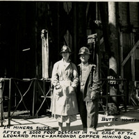
Caption: "Butte, Montana. In miner's suits after a 3,000 foot descent in the cage of Leonard Mine - Anaconda Copper Mining Co.," c. 1935, shows William and Grace McCarthy in miner's suits and helmets.
Date: 1935
-
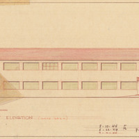
Caption: "Front Elevation (Wood Sash)." Color drawing of postwar building, California School for the Deaf at Berkeley. Design and drawing by Alfred Eichler, 1944; built in 1946. Project for Department of Education.
Date: 1944
-
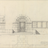
Caption: "Main Entrance, Cottage No. 11, Stockton Farm." Stockton State Hospital. Design and drawing by Alfred Eichler. Project for Department of Mental Hygiene - Hospitals.
Date: 1935
-
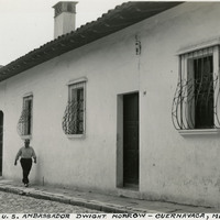
Caption: "Home of ex U.S. Ambassador Dwight Morrow - Cuernavaca, Mexico." Pictured is the former home of Dwight Whitney Morrow (1873-1931). Morrow was appointed Ambassador to Mexico by President Calvin Coolidge from 1927 - 1930.
Date: 1938
-
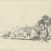
Caption: "Kitchen - Stockton State Hospital." Design and sketch by Alfred Eichler, c. 1932. Modified and built, contract architect. Project for Department of Mental Hygiene - Hospitals.
Date: 1932
-
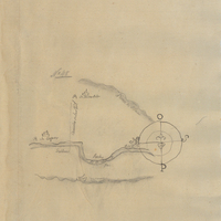
Hand-drawn sketch map of Monterey River boundaries. Volume 1, page 96.
Date: 1834