Search All Items
- Filters:
- Language
- English 7958
- Spanish 495
- ENGLISH 4
- English 2
- census_013 1
- contra_costa_schedule_1_volume_1 1
- Type
- Still Image 4047
- Image 3895
- Text 451
- Text 54
- Textual 2
- Image of the California Census from the records of the office of the California Secretary of State 1
Search Results 6451 to 6460 of 8628
-
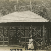
Caption: "Congress Springs.", c. 1910. Grace McCarthy seated on an unusual bench made from a tree branch and logs, in front of a timber shelter at Pacific Congress Springs, near Saratoga in California's Santa Clara Valley. Pacific Congress Springs, a mineral spring named after Congress Springs in New York, operated as a resort area from the nineteenth century until the 1930s. See also 96-07-08-alb05-108.
Date: 1910
-
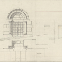
Sketch of Science Building Addition, Downtown Campus, San Francisco State College. Design and drawing by Alfred Eichler. Built. Project for Department of Education.
Date: 1935
-
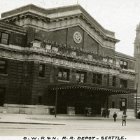
Caption: "O.W.R. & N. R.R. Depot -- Seattle.," c. 1915. Station building for the Oregon-Washington Railroad and Navigation Company, formed in 1910 from the Oregon Railroad and Navigation Company as a subsidiary of the Union Pacific Railroad. Designed by architect Daniel J. Patterson, the Beaux Arts-style station opened in 1911.
Date: 1915
-
Hand-drawn sketch map of Paso de Bartolo, Viejo. Volume 1, page 132.
Date: 1833
-
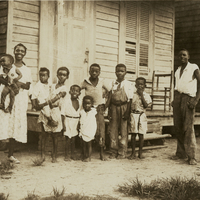
Unidentified African-American woman and several children posing on the porch of a wood-plank home. *Please Note:* Original caption removed due to sensitive content. To view the original photograph with caption, please contact the California State Archives Reference Desk.
Date: 6/17/1934
-
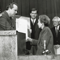
Patrick Johnston (middle) pictured at unknown ceremony to present resolution to woman
Date: c. 1982
-
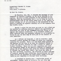
Correspondence from S. Martin Eidsath to Chester F. Gannon regarding reaction to hearing that took place on December 9 in Los Angeles
Date: December 19, 1943
-
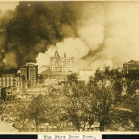
Caption: "The Fire Down Town." Fire engulfing buildings in San Francisco after the 1906 earthquake. Smoke plumes fill half of the photograph.
Date: 4/18/1906
-
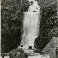
Caption: "Huntington Falls -- G.G. Park.," c. 1912-1915. Artificial waterfall in San Francisco's Golden Gate Park. Huntington Falls cascades down Strawberry Hill to empty into Stow Lake. The 110-foot-tall falls is named after Collis P. Huntington, one of the "Big Four" of the Southern Pacific Railroad Company.
Date: 1915