Search All Items
- Filters:
- Type
- Still Image 4044
- Image 3895
- Text 436
- Text 50
- Image of the California Census from the records of the office of the California Secretary of State 1
- Language
- English 7938
- Spanish 494
- ENGLISH 4
- English 2
- census_013 1
- contra_costa_schedule_1_volume_1 1
Search Results 7001 to 7010 of 8604
-
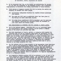
Summary of the cooperation between various agencies in providing medical care; brief statement of policy
Date: Undated
-
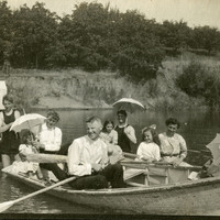
No caption, c. 1909. William McCarthy (second from the left) and a group of unidentified family and friends boating on a river or lake.
Date: 1909
-
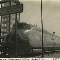
Caption: "Union Pacific Streamline Train. Chicago Fair. Sept. 22, 1934." View of the engine on the Union Pacific's new M-10000, on exhibit at Chicago's Century of Progress Exposition. The M-10000 was the first lightweight express passenger train powered by an internal combustion engine in the U.S. The train went on an exhibition tour of the US in 1934, which included a stop at the Exposition. The Exposition, a world fair attended by thirty-nine million people, celebrated Chicago's one-hundred year anniversary of incorporation. Originally planned to only run from May to November in 1933, it was such a success that its organizers decided to keep it running for a second season from May through October the following year. The central theme of the Exposition was technological innovation, with a motto of "Science Finds, Industry Applies, Man Conforms."
Date: 9/22/1934
-
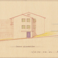
Caption: "South Elevation." Color drawing of postwar building, California School for the Deaf at Berkeley. Design and drawing by Alfred Eichler, 1944; built in 1946. Project for Department of Education.
Date: 1944
-
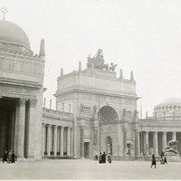
No Caption: Court of the Universe with collonnades and arch, at the Panama-Pacific International Exposition.
Date: 1915
-
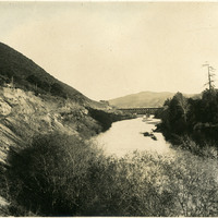
No Caption: Railroad trestle over Pajaro River at Watsonville, California, c. 1910.
Date: 1910
-
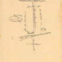
Hand-drawn sketch map of Guesesosi or Jesus Maria boundaries. Volume 2, page 178.
Date: 1842