Search All Items
- Filters:
- Type
- Still Image 4044
- Image 3895
- Text 436
- Text 50
- Image of the California Census from the records of the office of the California Secretary of State 1
- Language
- English 7938
- Spanish 494
- ENGLISH 4
- English 2
- census_013 1
- contra_costa_schedule_1_volume_1 1
Search Results 7551 to 7560 of 8604
-
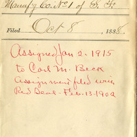
Red Seal, Our Charter, Pacific Coast Co-operative Cigar Manufacturing. Co
Date: 1888
-
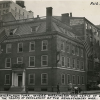
Caption: "Frances [sic] Tavern, New York. Where Washington Took Leave of Offices and Disbanded the Troops at Conclusion of the Revolutionary [sic] War. Aug. 5, 1934." Built as a family home for Etienne "Stephen" DeLancey in 1719, this building was converted to use as a tavern in 1762. It served many important functions before, during, and after the Revolutionary War, but several fires in the nineteenth century erased the building's original appearance. The Sons of the Revolution purchased the property in 1904 and embarked upon extensive restoration plans in 1907, supervised by William Mersereau. The building is now used as a museum and art gallery.
Date: 8/5/1934
-
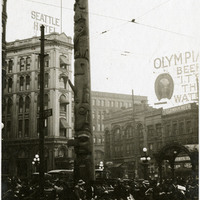
Caption: "Totem Pole -- Seattle, Wash.," c. 1915. View of the Tlingit totem pole in Seattle's Pioneer Square. The totem pole was stolen in 1899 by a group of businessmen, and erected in the square, then known as Pioneer Place. An arson destroyed this pole in 1938, but it was later replaced by another carved by the Tlingit tribe (who were also finally paid for the original pole).
Date: 1915
-
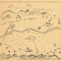
Hand-drawn sketch map of Santa Iasabel boundaries. Volume 2, page 81.
Date: 1843