Search All Items
- Filters:
- Language
- English 7958
- Spanish 495
- ENGLISH 4
- English 2
- census_013 1
- contra_costa_schedule_1_volume_1 1
- Type
- Still Image 4047
- Image 3895
- Text 451
- Text 54
- Textual 2
- Image of the California Census from the records of the office of the California Secretary of State 1
Search Results 7711 to 7720 of 8628
-
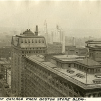
Caption: "View of Chicago From Boston Store Bldg," c. 1923. State Street, the Chicago Theatre, and the Wrigley Building (still under construction) can be seen in this bird's eye view of Chicago.
Date: 1923
-
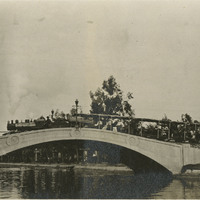
No Caption: shows the Venice Miniature Railway on a bridge over a canal in Venice, c. 1915.
Date: 1915
-
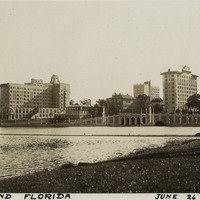
Caption: "Lakeland Florida June 26, 1934." View of the skyline of Lakeland across Mirror Lake. Founded by Abraham Munn and incorporated in 1885, the city of Lakeland is located east of Tampa.
Date: 6/26/1934
-
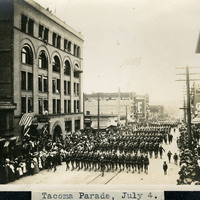
Caption: "Tacoma Parade, July 4.," c. 1905. View of an Independence Day parade in Tacoma, Washington, showing ranks of marching soldiers.
Date: 1905
-
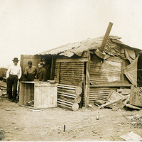
No Caption: See also 96-07-08-alb05-018 with caption: "Italian Refugee Hut S.F. 1906." Makeshift hut with four unidentified men standing in doorway. After the earthquake and fire that destroyed much of San Francisco in April 1906, hundreds of thousands of people were left homeless. Many of these people established temporary refugee camps, using debris from the destruction to cobble together shelters.
Date: 1906
-
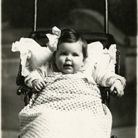
No caption, c. 1905. Unidentified baby in carriage, in front of what appears to be a photography studio backdrop.
Date: 1905
-
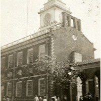
Caption: "Independence Hall - Philadelphia," c. 1925. Pedestrians outside of Philadelphia's Independence Hall, completed in 1753. The Declaration of Independence and the U.S. Constitution were both debated and adopted within the walls of this red brick state house.
Date: 1925
-
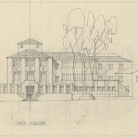
Drawing of South Elevation, Santa Barbara State College, by Alfred Eichler. Project for Department of Education.
Date: undated
-
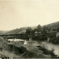
Caption: "Pajaro River, Watsonville," with railroad trestle spanning the river, c. 1910.
Date: 1910
-
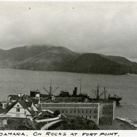
Caption: "Steamer Damara. On Rocks at Fort Point." On October 8, 1910, the British steam ship Damara, loaded with a cargo of barley bound for England, ran onto the rocks below Fort Point at the entrance to the San Francisco Bay. It took eleven days to refloat the ship.
Date: 1910