Search All Items
- Filters:
- Language
- English 7958
- Spanish 495
- ENGLISH 4
- English 2
- census_013 1
- contra_costa_schedule_1_volume_1 1
- Type
- Still Image 4047
- Image 3895
- Text 451
- Text 54
- Textual 2
- Image of the California Census from the records of the office of the California Secretary of State 1
Search Results 7791 to 7800 of 8628
-
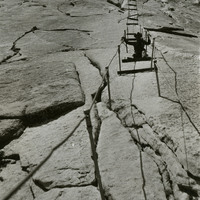
No caption, c. 1935. William McCarthy on the steep trail to the summit of the iconic Half Dome, in the Yosemite Valley. The cables used to assist hikers follow a route laid down by George Anderson, who reached the summit in 1875.
Date: 1935
-
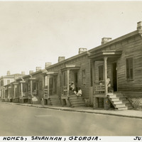
Caption: "Negro Homes, Savannah, Georgia. July 14, 1934." Row of identical small homes set closely together, each with a small front porch. Several unidentified people can be seen on a few of the porches.
Date: 7/14/1934
-
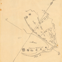
Hand-drawn sketch map of Cuyama or Cuyoma boundaries. Volume 2, page 203.
Date: 1846
-
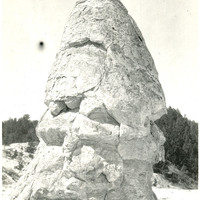
Caption: "Liberty Cap Rock - Mammoth Hot Springs," c. 1923. Liberty Cap Rock, a 40-foot tall dormant hot spring cone, is located in the Mammoth Hot Springs area of Yellowstone National Park.
Date: 1923
-
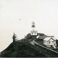
No Caption: See also 96-07-08-alb08-153 with caption: "Fort Canby Light House, Wash." c. 1910. View of the Cape Disappointment Lighthouse on a rocky point overlooking the mouth of the Columbia River. Cannons and cannon balls are stored on the lighthouse property. Built in the 1850s, the lighthouse was electrified in 1934 and automated in 1973. The lighthouse is now part of the Cape Disappointment State Park (formerly Fort Canby State Park).
Date: 1910
-
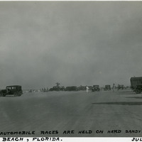
Caption: "Where Automobile Races are Held on Hard Sandy Beach, Daytona Beach, Florida. July 9, 1934." This photograph illustrates the wide, hard-packed sands of the beach at Daytona Beach, used by early motorists as a race track and testing ground for new vehicles. Bathers enjoy the surf to the left, while many automobiles are visible in the rest of the photograph.
Date: 7/9/1934
-
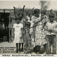
Caption: "Pima Indian Children and their hut made from bush branches, Sacaton Indian Reservation, Sacaton, Arizona," c. 1935. Located south of Phoenix and including the town of Sacaton, the Gila River Indian Reservation is home to members of the Akimel O’odham (Pima) and the Pee-Posh (Maricopa) tribes. The reservation was established in 1859. Eighty years later, in 1939, Congress provided for the self-governance of the reservation via the Gila River Indian Community.
Date: 1935