Search All Items
- Filters:
- Type
- Still Image 4044
- Image 3895
- Text 436
- Text 50
- Image of the California Census from the records of the office of the California Secretary of State 1
- Language
- English 7938
- Spanish 494
- ENGLISH 4
- English 2
- census_013 1
- contra_costa_schedule_1_volume_1 1
Search Results 921 to 930 of 8604
-
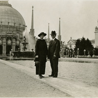
No Caption: Grace and William McCarthy standing before the Palace of Horticulture and reflecting pool, at the Panama-Pacific International Exposition. See also 96-07-08-alb01-054.
Date: 1915
-
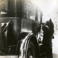
No caption, c. 1935. Grace McCarthy peers out of a car window at a curious bear in Yosemite National Park.
Date: 1935
-
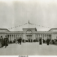
Caption: "France" French Pavilion at the Panama-Pacific International Exposition. The French Pavilion, an homage to the Palais de Legion d'Honneur in Paris, provided the inspiration for the Legion of Honor Museum in San Francisco.
Date: 1915
-
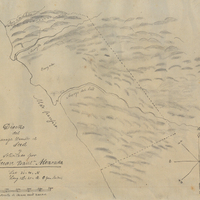
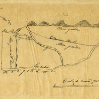
Hand-drawn sketch map of Sur or El Sur boundaries. Volume 1, page 68.
Date: 1834
-
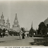
Caption: "On the Avenue of Palms," at the Panama-Pacific International Exposition.
Date: 1915
-
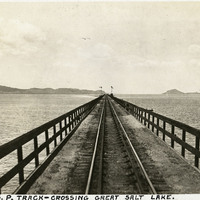
Caption: "S.P. Track - Crossing Great Salt Lake.," c. 1923. The Southern Pacific Railroad constructed the trestle shown in this photograph, known as the Lucin Cutoff, between 1902 to 1904. It crosses the Great Salt Lake, between Ogden and Lucin. The trestle was replaced by a causeway of dirt and rock in the 1950s.
Date: 1923
-
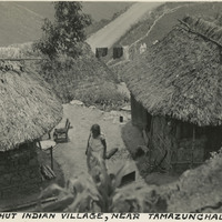
Caption: "Thatched hut Indian village, near Tamazunchale, Mexico."
Date: 1938
-
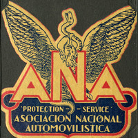
No Caption: A "ANA Asociacion Nacional Automovilistica 'Protection - Service," decal in yellow, red, and blue, with the Mexican symbol of an eagle holding a serpent in its beak and talons, based on the Aztec symbol that represented the founding of the city, Tenochtitlan, today Mexico City.
Date: 1938